This is a first in a series of blogs on community-led tree-based intervention to build climate resilience. Please read the second blog here.
The ever-increasing concrete surfaces in our cities absorb heat from solar irradiance, making the overall atmosphere unbearably hot and escalating energy demands by the residents. This phenomenon is better known as the ‘heat island effect’. Our cities also grapple with steadily rising levels of air pollution. To combat these stresses and make our cities more sustainable and liveable, we need to invest in Nature-based Solutions (NbS) (Augusto et al., 2020; Chakraborty et al., 2022; Majidi et al., 2018). An ecosystem-based approach can address multiple socio-economic issues, including human health, food and nutritional security, livelihood, and the extreme weather events caused by climate change (IUCN, 2020).
Urban green spaces can help maintain micro-climate conditions and improve thermal comfort by lowering the urban heat island effect. Moreover, green spaces can help reduce air pollution and provide multiple ecosystem services. These NbS interventions can be strategized and implemented even better with the help of tools like satellite remote sensing and geographic information system (GIS), as these tools enable effective monitoring of existing tree cover resources and prescribing suitable interventions.
Co-designing Solutions with Citizens of Kochi under Cities4Forests Initiative
Kochi, Kerala’s financial capital and industrial hub, is located on the western coast of India, and is highly vulnerable to extreme climate events. The city has witnessed several disasters in recent years and is continuously grappling with the impacts of rising sea levels and frequent flooding due to erratic monsoons. In addition to this, the city is struggling with an unprecedented rise in urban heat. A recent assessment by WRI India during the winter seasons from 2017 – 2020 reveals that more than 30% of Kochi’s inhabitants are susceptible to temperatures higher than 35 degrees Celsius. In 2019, Kochi became the flagbearer of the global Cities4Forests initiative in India, which focuses on spreading awareness of the importance of trees and forests in climate change mitigation and adaptation. Identifying heat as a critical issue, the Kochi Municipal Corporation (KMC) initiated a series of interventions to mitigate rising temperatures and flood intensity in the city with technical support from WRI India.
Mapathon Events for Data Collection using Collect Earth
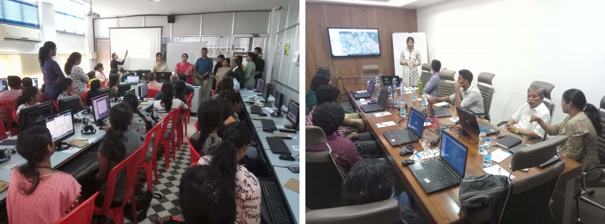
As a first step, the Kawaki initiative was launched. The word Kawaki is formed from two Malayalam words, kawu (grove) and aki (make), which translates to “make a grove”. As part of this initiative, a geospatial assessment (mapathon) was conducted in Kochi involving the citizens and KMC. Two events involved citizens and used local knowledge in developing base layers on existing tree cover, species occurrence, the potential for improving the tree cover, and land ownership. This approach blended local knowledge and satellite imaging technology in developing different data layers. Members from social groups, resident associations, and ward councillors participated in these events. Students from various academic institutes, such as St.Teresa’s College, Kerala Agriculture University, and the School of Architecture, Mookambika Technical Campus, volunteered for image analysis and data entry. The Collect Earth platform was used in mapathon events that enabled analysis and interpretation of high-resolution satellite imagery (from Google maps, Bing maps, and DigitalGlobe imagery) for data collection.

Planning Restoration Interventions
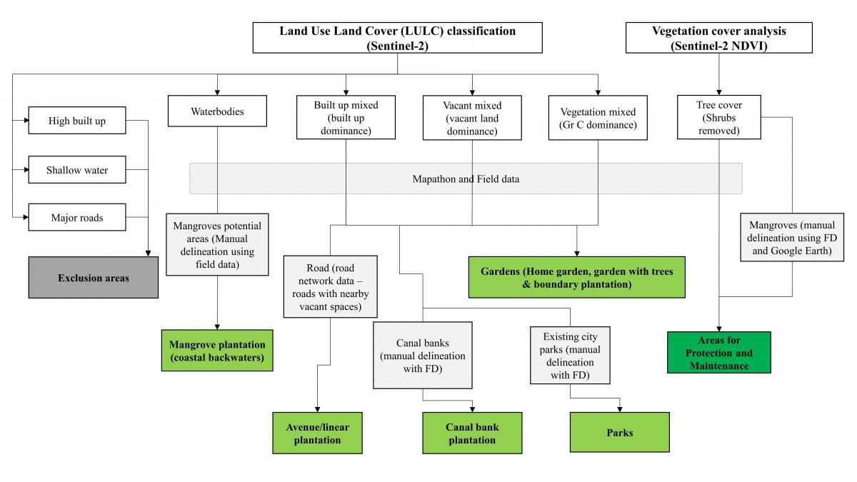
The publicly available Sentinel-2 images (S2) were analyzed for land use land cover (LULC) and green cover mapping. The data collected through the mapathons were employed to develop a tree-cover baseline map and identify suitable tree-based restoration interventions and site selection. Based on geostatistical data analysis, a tree-based restoration framework for Kochi was developed (Figure 2). Multiple field visits were conducted to collect ground data and verify the potential areas identified for improving tree cover.
The total potential area for increasing tree cover in Kochi is limited due to congested constructions, limited space between roads and private lands (in several places, there is very little space between roads and houses), lack of open spaces, and existing tree cover in the city (Balasubramanian et al., 2022). The spatial data analysis identified the built-up areas and limited vacant lands where suitable tree-based interventions like home gardens and plantations in the plot and along the boundaries can be carried out. The existing green cover, including mangroves, has been prescribed for protection and maintenance.

Several sites were shortlisted for tree-based interventions based on geospatial data analysis, fieldwork and community consultations. After site selection, multiple consultations were organized with stakeholders who expressed their interest in supporting the implementation.
Way Forward
The NbS -based approach adopted for mitigating urban heat issues in Kochi can be upscaled to other landscapes by employing suitable satellite remote sensing data and participation of local citizens, governmental and non-governmental organizations, and entrepreneurs engaged in improving green cover (as being done under initiatives such as Land Accelerator South Asia).
As these trees grow in a city, it increases the canopy cover and the resulting aboveground carbon sequestration can be assessed using suitable satellite imagery and ground data. Trees in urban areas are mostly in small patches and thus are considered Trees outside Forests (ToF) since the patch size is below 1 ha. While their smaller patch size can be challenging for mapping and monitoring, a recent data system developed by WRI, Trees in Mosaic Landscape data, can monitor such tree cover growth in tropical regions and can significantly benefit scaling of ToF models, particularly in urban areas. Past studies have reported the annual average benefit per tree for aesthetics and amenity ($51 or ~INR 4223), shading ($26 or ~INR 2153), water regulation ($11 or ~INR 911), air quality ($7 or ~INR 580) and carbon reduction ($3 or ~INR 248).

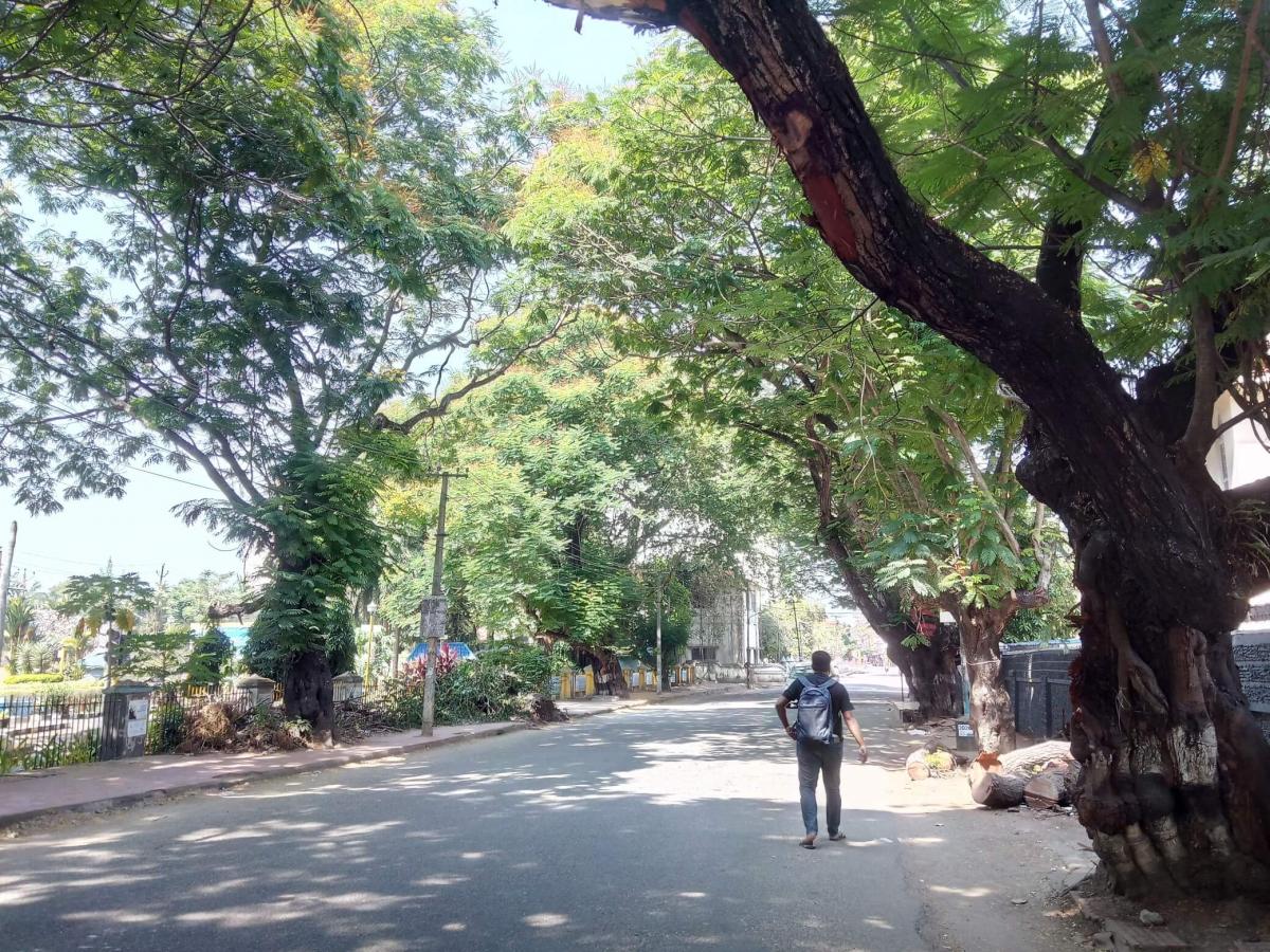
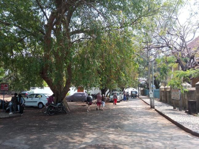
The economic and ecosystem benefits of ToF models, including maintaining the land surface temperature and associated processes (Figure 3), are well-recognized and supported under several national and state level policies and schemes in India, including Green India Mission and National Agroforestry Policy, among others. The urban forest scheme, announced by the Ministry of Environment, Forest and Climate Change, Government of India in 2020, is also one such incentivizing scheme which aims at developing 200 ‘Nagar Van’ (urban forests) across the country. With these enabling factors and an accurate and efficient planning, implementation and monitoring process, improving the country’s forest and tree cover can help India mitigate climate challenges for its population while achieving its national and internal climate commitments, including Nationally Determined Contribution targets and Sustainable Development Goals.
Views are personal.
AUTHOR:
Pulakesh Das – pulakesh.das@wri.org
Sidhtharthan Segarin – sidhtharthan.segarin@wri.org

